
Find Records Along a Hillsboro Street
A Hillsboro street search begins with one known address. Washington County publishes parcel-focused tools, so a street directory is built address by address rather than by entering a road name and receiving a household list. InterMap links an address to a tax lot, R number, map/account information, and legal description. Those identifiers make the next record check more reliable. A property record can identify an owner or tax-mailing contact, while a recorded deed establishes a party role on a dated transfer. Neither fact alone proves who is physically present at the address.
For a current street question, preserve the address exactly as searched and log the source date. Move from parcel information to the transfer record, then use historical material only for the period it covers. The official voter-file channel is separate and regulated. It is not a public street-browse tool.
- Enter the street address in Washington County InterMap and record the tax-lot ID, R number, map/account reference, situs, and legal description.
- Open Additional Information, then the Assessment & Taxation Information subreport, to distinguish ownership and tax-mailing fields from the physical situs.
- Use the legal description and current owner to locate the acquisition record through the Recording Office’s public research route or a scoped copy request.
- When a plat, road, or subdivision question interrupts the address trail, use Survey Explorer for the map and survey context before treating an old street label as the same parcel.
- For a lawful official voter-file request, use the Oregon Elections or county channel and retain the statutory exclusions. For historic occupants, compare dated directory, newspaper, census, and property evidence.
Note: A parcel trail documents property and dated record roles, not a complete roster for every Hillsboro address.
Hillsboro Street Directory Parcel Keys
Assessment & Taxation’s published instructions confirm three InterMap inputs: address, Taxlot ID, and R number. That limitation matters. The county did not document an owner-name-only, ZIP-wide, or whole-street lookup form. Start with a precise address, then carry the resulting parcel identifiers into each later search. The subreport’s General Property Information, Sales/Deed Information, Assessed Values, Improvement Information, and Improvement Details categories describe the address record more fully than a street-name search could.
The county’s Property Values & Improvements instructions show the route from an InterMap result to the assessment subreport.
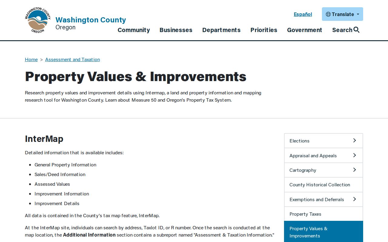
Use the screen as a route to the parcel record, then keep the legal description with any older deed or map finding.
| InterMap input | Use in a Hillsboro by-address search |
|---|---|
| Address | Begins a parcel-specific search from a known situs. |
| Taxlot ID | Reconnects a parcel across map, survey, and assessment work. |
| R number | Provides the county’s other confirmed property lookup route. |
Reading a Hillsboro Address Subreport
A Hillsboro street directory needs a careful reading of the assessment fields. The county’s sample tax-statement material separates Key Property Data from Ownership and Mailing Address. Key data includes the property address, legal description, map number, and account number. The ownership area names the party responsible for the tax statement and gives a mailing address. Real Market Value, Maximum Assessed Value, Taxable Value, payment details, and a listed veteran exemption can also appear in the tax material.
The sample property-tax statement makes the distinction visible.
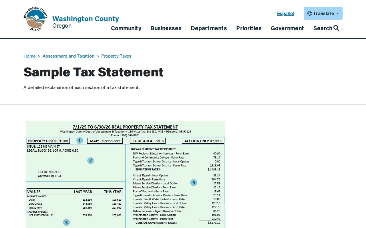
A tax mailing address is where the statement is sent. It is not evidence that its recipient is at the mapped Hillsboro situs.
- Parcel
- A mapped unit of land used to connect assessment and title records.
- Situs address
- The physical assessed location of the property, which may differ from a tax mailing contact.
- Legal description
- Lot, block, subdivision, survey, or other land language that persists when an address changes form.
- Plat
- A recorded map that lays out lots, blocks, roads, or a subdivision.
Survey Explorer for Hillsboro Streets
Survey Explorer is the companion tool when a Hillsboro address turns into a lot, block, road, or survey question. It lists addresses, tax lots, surveys, plats, government corners, benchmarks, section maps, county roads, geodetic controls, and donation land claims. That breadth is useful when a deed gives survey language instead of a street number. Its public disclaimer also says county data carries no warranty for errors, omissions, or positional accuracy. Treat it as research support, not a legal boundary opinion.
The Survey Explorer search form requires a Search For selection and exposes fields suited to land-record work.
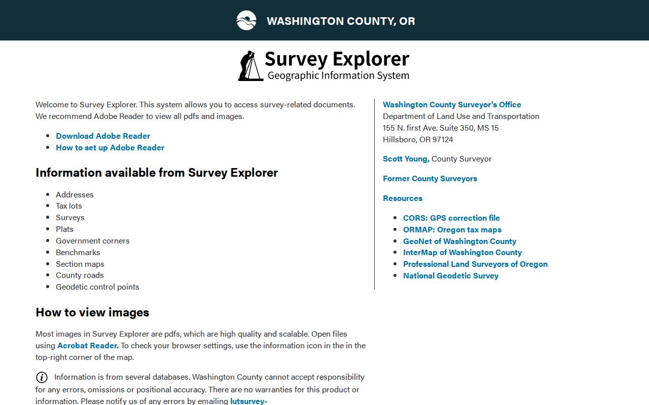
The form helps translate a street clue into survey or plat context before a recorded legal description is compared.
| Survey Explorer field | Type | Search note |
|---|---|---|
| Search For | Select, required | Choose the available record or map category. |
| Survey # | Text | Use a survey number when one appears in a deed or plat lead. |
| County Road Number | Text | Help allows leading-zero, fraction, A, and market-road formats. |
| Filed From / Filed To | Date text | Use YYYY-MM-DD for a filing-date range. |
| Town/Range, Section, QTR | Select | Narrows a land description by the survey grid. |
| City | Select | Filters the Survey Explorer search by city selection. |
Hillsboro Street Directory Deed Eras
The recorded-transfer trail is party and legal-description based. From the assessment result, identify the current owner’s acquisition record, note the grantor, grantee, recording date, document or book/page reference, and legal description, then search the former owner as a prior grantee. That reversal can extend the title chain, but each result remains a dated transfer record. It does not supply a street-wide resident list.
Washington County Recording provides the local route to document research and copies.
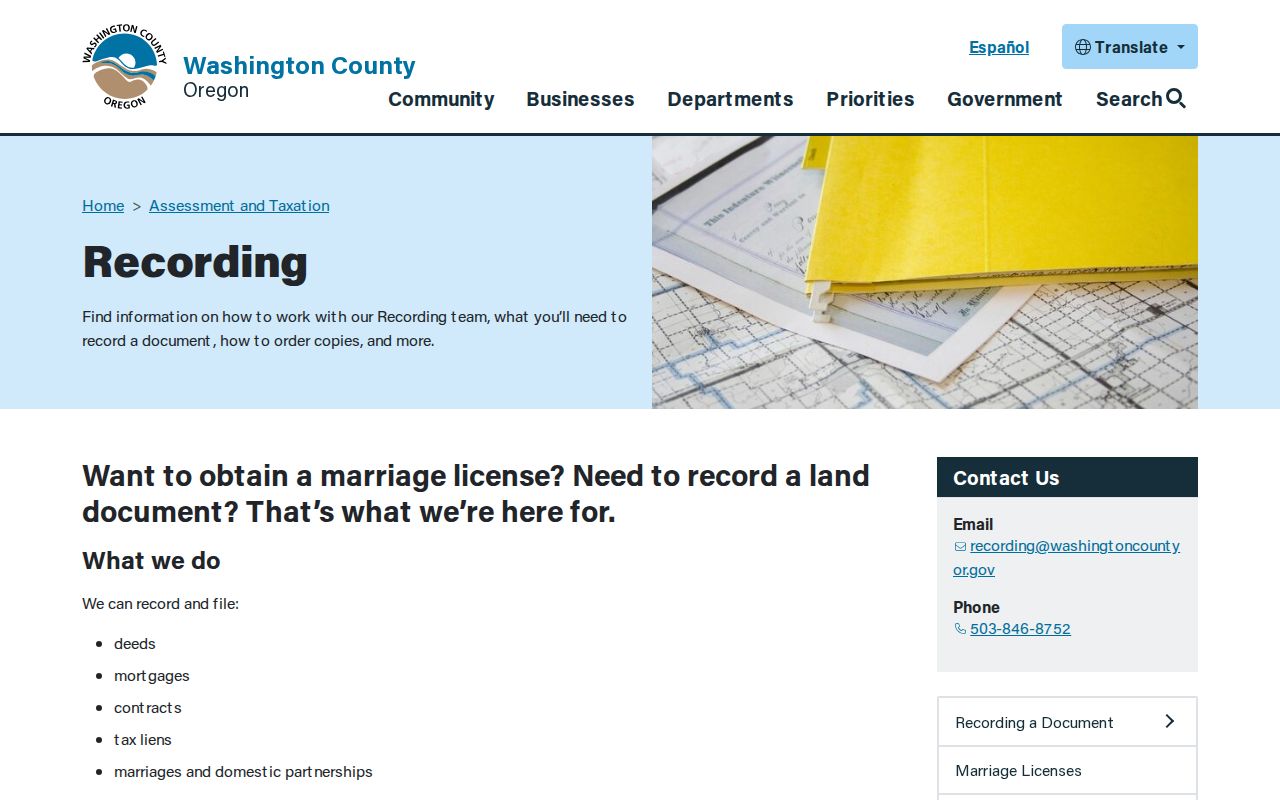
The Recording Office is especially important because its access changes by era: searchable Book of Records images are available on Suite 130 public-research computers from 1979 forward, while direct and indirect deed indexes for 1850 through 1977 are on local microfilm.
Lobby computers are free to use. Self-printed copies cost 50 cents per page. Staff-made copies cost $4 for the first page and 25 cents for each additional page, and a certified copy adds $3.75 to the staff-made charge. Phone or email copy requests require prepayment. The county’s direct index follows grantors and the indirect index follows grantees, so bring names, approximate dates, and parcel information rather than a street name alone.
Note: The 1979 image cutoff describes on-site public-research access, not a promise of remote document images.
Hillsboro Street Permits as Date Clues
City Development Services records can add a dated construction or alteration clue to a Hillsboro street history. The public-records request form calls for information such as a project or permit number, job-site address, date range, document type, and requested format. Certificates of occupancy, permits, and drawings follow this municipal route. They can show what a particular file records, but they do not establish every person associated with an address over time.
The Hillsboro Development Services request form states that staff research is free for the first 30 minutes and costs $55 per hour after that. A focused request can avoid a broad search and a large cost estimate. Oregon Public Records Law permits access to nonexempt material, while the custodian still removes protected content. Keep a permit result beside its requested address and date range. A project record may explain a change to a structure or street-side parcel, yet it does not replace a deed, tax roll, or dated historical source.
Hillsboro Street Records by Address
Different address-keyed sources answer different parts of a Hillsboro street question. The map establishes the parcel. Assessment material identifies ownership and tax contacts. Recording follows a dated title role. Survey records explain legal geography. Historic sources add a period-specific human or building clue. Combining them prevents a street directory from turning one narrow record into a broad claim.
| Hillsboro source | Address connection | Best use | Access route |
|---|---|---|---|
| InterMap assessment subreport | Address, tax lot, R number | Property, deed, value, and improvement categories | Free county map |
| Tax statement / assessment record | Legal description, map, account | Owner and tax-mailing distinction | Current tools and historic rolls |
| Recording Office | Party plus legal description | Dated grantor-grantee transfer chain | Suite 130, microfilm, or copy request |
| Survey Explorer / plats | Tax lot, lot/block, road | Survey and subdivision context | County web tool and archives |
| Development Services | Job-site and project detail | Permit, drawing, or occupancy record request | City request process |
| Brookwood historical material | Dated street or address clue | Maps, directories, and newspaper context | Library reference and microfilm |
For a history that reaches beyond modern parcel data, retain the legal description and map number. They are more durable than assuming that a current street label identifies the same place in every older source.
Historic Hillsboro Street Context
Brookwood Library supplies the historical layer that a current Hillsboro street directory cannot. Its genealogy resources include Hillsboro Sanborn microfiche for 1884 through 1921, local newspaper microfilm, historical court and marriage microfilm, and an obituary finder. Sanborn sheets help date a building footprint, street pattern, or use. They do not name every household. Brookwood also has a WCCLS reference entry for the Johnson Hillsboro City Directory beginning in 1959, although the availability of a particular issue should be confirmed with staff.
The local newspaper route is split by format and date. Brookwood keeps the Argus through March 2012 and the Independent through 1931, while selected historic titles are searchable through the Historic Oregon Newspapers project. A directory or newspaper line should be logged as a dated observation, not proof of continuous residence. The historical collections themselves are described in the Hillsboro city directories.
Hillsboro Voter Lists and Street Limits
Oregon does not provide a confirmed self-service endpoint for browsing voters along a Hillsboro street. Oregon My Vote is a registration-status service, not an open third-party street search. A lawful official list request follows the state or county process under ORS 247.945 and ORS 247.948. The Elections Division says an electronic statewide or smaller-than-statewide file may be requested through SFTP; non-electronic smaller requests go to the county elections official.
The Oregon voter-list request instructions list a $500 statewide fee, or a $25 setup charge plus 2.5 cents per 100 records for a smaller-than-statewide electronic list, and state a 10-business-day completion allowance. Address Confidentiality Program participants and nonpublic fields are excluded. These restrictions are part of the record, not a gap to work around.
Limits of the Hillsboro Street Directory
A Hillsboro street directory cannot turn property, title, permit, or historical sources into a complete present-day household list. A tax statement records the responsible party and mailing contact, which can differ from the parcel situs. A deed records parties to a transfer. A Sanborn map records a building and its map-era setting. Utility and delivery customer information are not public street-directory records, and motor-vehicle personal information is protected by the federal Driver’s Privacy Protection Act.
Protected elector information, Address Confidentiality Program records, sealed or exempt material, and custodian redactions may correctly produce no result. If a record is wrong, ask the agency that maintains it about its correction process. A missing result does not justify searching around a protected person.
Lawful use. Use Hillsboro address records for personal, lawful research and respect the limits set by each custodian. Oregon stalking and harassment laws, including ORS 163.732 and ORS 166.065, still apply to conduct.